


QField for QGIS

QField for QGIS का विवरण
QField - व्यावसायिक जीआईएस डेटा संग्रह करना आसान बना दिया गया
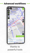
QField कुशल, पेशेवर-ग्रेड जीआईएस फील्डवर्क के लिए सर्वोत्तम मोबाइल ऐप है। क्यूजीआईएस की शक्ति पर निर्मित, यह पूरी तरह से कॉन्फ़िगर की गई जीआईएस परियोजनाओं को आपकी उंगलियों पर लाता है - ऑनलाइन या पूरी तरह से ऑफ़लाइन।
🔄 निर्बाध क्लाउड सिंक्रोनाइज़ेशन
QFieldCloud के साथ वास्तविक समय में सहयोग करें-क्षेत्र और कार्यालय के बीच, यहां तक कि दूरदराज के क्षेत्रों में भी, डेटा और परियोजनाओं को सहजता से सिंक करें। ऑफ़लाइन किए गए परिवर्तन संग्रहीत होते हैं और कनेक्टिविटी बहाल होने पर स्वचालित रूप से समन्वयित हो जाते हैं।
जबकि QFieldCloud सबसे सहज अनुभव प्रदान करता है, उपयोगकर्ता अपने पसंदीदा तरीकों के माध्यम से काम करने के लिए स्वतंत्र हैं। QField USB, ईमेल, डाउनलोड या SD कार्ड के माध्यम से डेटा लोड करने का समर्थन करता है।
📡 उच्च परिशुद्धता GNSS समर्थन
अपने डिवाइस के आंतरिक जीपीएस का उपयोग करके सटीक डेटा कैप्चर करें या ब्लूटूथ, टीसीपी, यूडीपी या मॉक लोकेशन के माध्यम से बाहरी जीएनएसएस रिसीवर कनेक्ट करें।
🗺️ मुख्य विशेषताएं:
• .qgs, .qgz, और एम्बेडेड QGIS परियोजनाओं का समर्थन करता है
• कस्टम फॉर्म, मानचित्र थीम और प्रिंट लेआउट
• ऊंचाई, सटीकता और दिशा के साथ वास्तविक समय जीपीएस ट्रैकिंग
• कहीं भी स्थानिक डेटा का ऑफ़लाइन संपादन
• QFieldCloud के साथ प्रोजेक्ट और अपडेट सिंक करें (वैकल्पिक)
📦 समर्थित प्रारूप:
वेक्टर: जियोपैकेज, स्पैटियालाइट, जियोजसन, केएमएल, जीपीएक्स, शेपफाइल्स
रैस्टर: जियो टीआईएफएफ, जियोस्पेशियल पीडीएफ, वेबपी, जेपीईजी2000
🔧 अनुकूलित करना या नई सुविधाएँ जोड़ना चाहते हैं?
https://www.opengis.ch/contact/ पर हमसे संपर्क करें
🔐 अनुमतियाँ
QField आपकी स्थिति प्रदर्शित करने और स्थानिक डेटा एकत्र करने के लिए स्थान पहुंच का अनुरोध कर सकता है। बाहरी जीएनएसएस उच्च परिशुद्धता आवश्यकताओं के लिए पूरी तरह से समर्थित है।
❓ प्रश्न या मुद्दे?
बग की रिपोर्ट करें या सुविधाओं का अनुरोध करें: https://qfield.org/issues
QField for QGIS - Version 3.6.4 - Gondwana
(06-06-2025)
QField for QGIS - एपीके जानकारी
एपीके संस्करण: 3.6.4 - Gondwanaपैकेज: ch.opengis.qfieldLatest Version of QField for QGIS
अन्य संस्करण


 4.33
4.33
Apps in the same category

You may also like...


